RFP


RIVER TRAIL DRIVE - REQUEST FOR DEVELOPMENT PROPOSALS (RFP)
July 9, 2008

The City of Peoria is seeking a quality developer to develop City owned RIVERFRONT property. The City Council, the Planning Commission, and the Heart of Peoria Commission have approved the River Trail Concept Plan.Preference is for new urban AND green development.

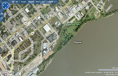
The City of Peoria seeks proposals from qualified developers for the development of the Peoria Riverfront north of downtown. The City owned property fronts a beautiful lake measuring approximately 2.5 miles by 1.5 miles, a lineal park, and a bike trail. The south end of the property is anchored by downtown Peoria, I-74, and the Riverplex. The north end is anchored by the Detweiller Marina.

Background: City staffs have developed concept plans for the Peoria Riverfront. Staff gave numerous community presentations and held several charettes to get community input. Presentations were made to the City Planning Commission and the Heart of Peoria Commission and they approved the plans for the River's Edge Redevelopment Initiative, the Green Edge Plan, the River Trail Drive Plan, and the Cascade River Plan. All of the plans were reviewed and approved by city engineering and planning staff.

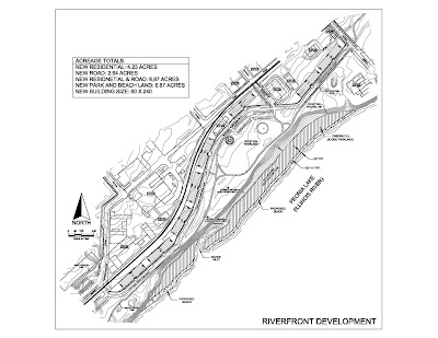
The Concept Plans begins with City owned land, as shown on the attached concept plan sketch. There are approximately nine city owned acres available for development. There is a substantial amount of privately owned land that could be added to the development. The plan is similar to the famous "Burnham Plan" in Chicago, with a lake shore drive and quality housing to help pay for it.

There is a strong demand for housing in and near downtown Peoria. Several market studies have been conducted with the most recent being completed by Tracy Cross & Associates, Inc. The Tracy Cross Residential Market Analysis indicated that there would be a demand for 194 new dwelling units a year in downtown Peoria.

Downtown Peoria is the second most densely developed downtown in Illinois after Chicago, boasting over 17,000 jobs. Many of the young professionals employed downtown have indicated a desire to live close to downtown jobs, the river, and the convention center. Employment in Peoria continues to grow with new jobs being created by Caterpillar, OSF Medical Center and Methodist Medical Center.

More information is available on:


Possible City Contributions


Depending upon the quality of submittals,participation may include the following:


* Enterprise Zone incentives


* A favorable purchase price or transfer of real property at reduced cost


* Possible Tax Increment Financing (TIF) Incentives


City’s Right to Reject Proposals


The City of Peoria reserves the right to reject any and all proposals received as a result of the Request for Proposals, or to negotiate in any manner necessary to serve the best interests of the City. If a minority and/or female owned small business is included, then a Business Plan for that small business must also be included.

Meeting / Inspection: City Staff invite interested parties to call or email to arrange a presentation and a walk through of the site. Submittals may be made until one is accepted and approved by the City Council.


Proposals or Questions should be sent to:


or

Craig Hullinger AICP Hullinger@gmail.com

Economic Development Department

City of Peoria

419 Fulton Street, Suite 403

Peoria, IL 61602

Phone (309) 494-8642

Fax (309) 494-8650
Printable Version of the RFP
-
-

Islands and Plat

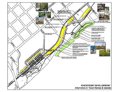
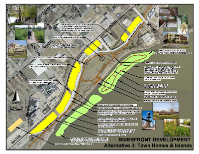
The images below show the River Trail Drive plan with proposed islands. They were developed by the Environmental Engineering firm, LRMG.

The islands would be built from dredge material from the Illinois River. Both islands would restore the Riverfront to a more natural setting, with wetland and ecosystem restoration. One island would have a bikeway and trail access, the other would not have access and be dedicated to bird nesting areas. These plans area conceptual, and the design refined.


Click on the Concept Plan Plat above to see more detail. This plat covers city owned land south of Spring Street. The City owns some land above Spring Street which could be included. There are also a number of privately held properties that could be purchased to expand the development area.

Potential Mixed Use Buildings


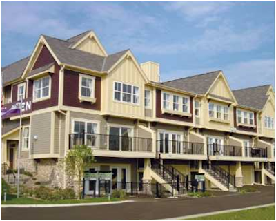
A building like this would be an appropriate use. The building should be new urban and "green". The first floor in this unit is partially garage parking, with some retail at street level. It can be built on the 60 feet deep building pads shown on the plan.

Townhouse Prototype


New urban townhomes with rear loaded garages similar to these units would be appropriate for River Trail Drive.

Peoria Lake


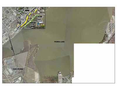
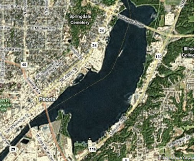
The proposed River Trail Drive development is located on the Peoria Lake in the lower left corner of the aerial. It looks out over a lake 1.5 miles by 2.5 miles long, anchored by the Marina on the north, and downtown and I-74 on the south.


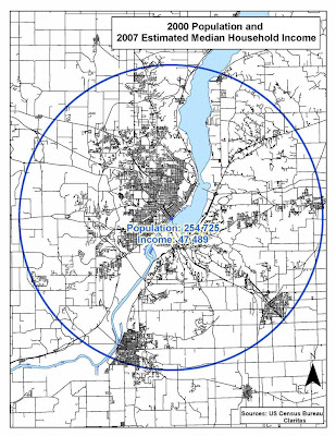
Population and Median Household Income


Downtown Peoria is:
167 miles south of downtown Chicago
and
168 miles from downtown St Louis

Big Build Up

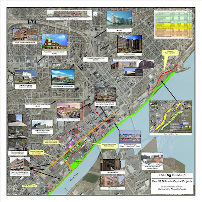
Click on the map above to see more detail about the amount of development in and near downtown Peoria. The proposed River Trail Drive Plan is on the mid right side of the map. Easy walking distance to our downtown, with the second highest concentration of jobs in Illinois.

Views From the Site


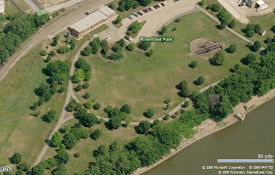
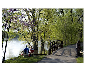
Views of the Illinois River and Lake Pimeteau

Peoria is looking for Developers for River Trail Drive


The City Council, the Peoria Planning Commission and the Heart of Peoria Commission have approved the River Trail Drive Plan. City Council has authorized an effort to seek a quality company to develop the site. The plan is to create quality housing overlooking the Illinois River and Lake Pimeteau. The development will create a drive along the lake, providing all people to drive along the river, similar to Grand View Drive. A kind of "low rise". Grand View. Park islands will be developed to further enhance the riverfront.

Background: City Council authorized city staff to develop and refine plans for the Peoria Riverfront, and to take those plans to the public and City Commissions. Numerous presentations and charettes have been completed. The Heart of Peoria Commission and the Planning commission have approved the plans for the River's Edge Redevelopment Initiative, Green Edge Plan, River Trail Drive Plan, and the Cascade River Plan

1. The plans implement the urban redevelopment recommended in the comprehensive Plan and Heart of Peoria Plan. These plans call for the redevelopment of older neighborhoods, and the revitalization of the Heart of Peoria with new urban development.

2. The plans are consistent with and follow the goals, objectives, and recommendations of the Comprehensive Plan and Heart of Peoria Plan.

3. The plans were subject to extensive citizen participation, including meetings with neighborhoods groups, environmental groups, developers, individuals, the Heart of Peoria Commission, Park District staff, the Park District Board, the Corps of Engineers, IDNR, FEMA, public hearings before the Planning Commission, and a charrette with citizens and the Planning Commission. They were also subject to a charrette attended by a number of environmental professional agencies and governments.

4. The plans were presented to Planning Department staff, the city manager, Public Works and the One Stop Shop.

5. The Cascade Plan was developed in response to comments made at the Planning Commission public hearing and at other public meetings, where a number of people objected to blocking views of the River such as created by PMP, the Riverplex, and other developments. They also suggested that we put more effort into redeveloping the neighborhoods back from the river. The Cascade Plan calls for maintaining and improving views to the River as buildings are demolished, and also calls for revitalization of the neighborhoods.

6. The Heart of Peoria Commission considered the plans, and recommended their adoption (They did not see the Cascade Plan, which was developed later.)

7. A number of developers have been contacted about these possible developments, and some have expressed interest.

8. The plans are similar to and consistent with the plan of Grand View Drive, which incorporates views of the River, parks, a drive providing overlooks of the lake and park, and housing on the side away from the river, providing the tax resources to pay for the streets.

9. The plan is similar to the famous "Burnham Plan" in Chicago, which created the lake front park system with Lake Shore Drive and housing to help pay for the drive. The Burnham Plan calls for open views of the water, with parks adjacent to the water, bike trails, a road, and housing on the side away from the water - similar to our plans.

10. The plan would eventually interconnect Water Street and downtown with Grand View Drive. This will likely take many years to complete, and relies on the voluntary support of 8 land owners. All these land owners were contacted, and asked to consider donating the part of their land that lies between the River and the flood way line. They were also asked to donate an additional 50 feet of right of way for the eventual construction of River Trail Drive. Some of the eight owners are actively considering this donation.

11. The Planning Commission after public hearings, site investigations and a design charette, approved the River’s Edge Redevelopment Initiative Concept Plan, including the Green Edge Concept Plan, the River Trail Drive Concept Plan, and the Cascade Concept Plan.If the City Council approves, we will look for a developer. The City prefers new urban, "green" development.


More info under: